Free travel home page with storage for your pictures and travel reports! login GLOBOsapiens - Travel Community GLOBOsapiens - Travel Community GLOBOsapiens - Travel Community
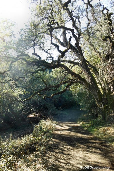
 You are here: Member pages » el2995 » pictures » The Alambique Trail, Wunderlich County Park
Login
 Forgot password?
sign up


Top 3 members
wojtekd 55
pictor 40
Member snaps
el2995

The Alambique Trail, Wunderlich County Park's by el2995

about me      | my friends      | pictures      | albums      | reports      | travel log      | travel tips      | guestbook      | activities      | contact      |

previous Show next picture from el2995 show bigger picture send as postcard

information about united-states  WoodsideUnited States, California
Scenes along the Alambique Trail. The first roughly 1.8 miles of the trail is barely - to - unpaved service road, though After Alambique Flat, the trail is more a narrow dirt track, and remains so along the Skyline Trail and back along the Alambique after passing The Crossroads. A trail map for Wunderlich County Park can be found through: http://www.co.sanmat-eo.ca.us .
Uploaded: Nov, 08 2012 | Taken: Nov, 03 2012| Viewed: 10 times  | 1 vote
Camera: NIKON | Model: COOLPIX S6200 | Exposure 10/800s, ISO 80 | FLength: 5mm | SW: COOLPIX S6200V1.0


el2995 's travel pictures
Page: 1 2 3 4
Burma
    Amarapura (3)
    Bago (11)
    Kyaikto (2)
    Kyauktan (5)
    Mandalay (35)
    Maymyo (4)
    Mingun (1)
    Pagan (35)
    Rangoon (16)
    Sagaing (10)
    Thadon (1)
    Thaton (1)
    Twante (3)
    Yangon (33)
Cambodia
    Siem Reap (118)
France
    Paris (2)
Indonesia
    Bangli (2)
    Batur (1)
    Jimbaran (3)
    Ubud (7)
Publish your own story!


  Terms and Conditions    Privacy Policy    Press    Contact    Impressum
  © 2002 - 2024 Findix Technologies GmbH Germany    Travel Portal Version: 4.2.8