The Parc du Mercantour covers some 685 km², consisting of a central uninhabited zone comprising seven valleys - Roya, Bévéra, Vésubie, Tinée, Haut Var/Cians plus Verdon and Ubaye and a peripheral zone comprising 28 villages. Many of them are perched villages, concealing great architectural riches (numerous churches decorated with murals and altar pieces by primitive Niçois painters). More than 150 rural sites are located within the Park.
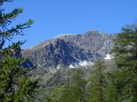
This is a beautifully rugged national park where the beautiful mountain streams and lakes set in the valleys of 3000m-high mountains. You can see chamois, Ibex, mountain goat, as well as marmots, white hares and cattle and a lot of flowers.
In the Vallée des Merveilles, at the base of Mt. Bégo are more than 100,000 rock engraving, many of them prehistoric.
The Parc du Mercantour covers some 685 km², consisting of a central uninhabited zone comprising seven valleys - Roya, Bévéra, Vésubie, Tinée, Haut Var/Cians plus Verdon and Ubaye and a peripheral zone comprising 28 villages. Many of them are perched villages, concealing great architectural riches (numerous churches decorated with murals and altar pieces by primitive Niçois painters). More than 150 rural sites are located within the Park.
This is a beautifully rugged national park where the beautiful mountain streams and lakes set in the valleys of 3000m-high mountains. You can see chamois, Ibex, mountain goat, as well as marmots, white hares and cattle and a lot of flowers.
In the Vallée des Merveilles, at the base of Mt. Bégo are more than 100,000 rock engraving, many of them prehistoric.
|